skip to main |
skip to sidebar
 Pagodipuu - Japanese Pagodatree (Sophora japonica)
 Kanadannuppupuu - Eastern Redbud (Cercis canadensis)
 Tuoksusumakki - Fragrant Sumac (Rhus aromatica)
 Katsura - Katsura tree (Cercidiphyllum japonicum)
 Kolmioka - Honey Locust (Gleditsia triacanthos)
 Valeakaasia - Black Locust (Robinia pseudoacacia)
 Kentuckynkahvipuu - Kentucky Coffeetree (Gymnocladus dioica)
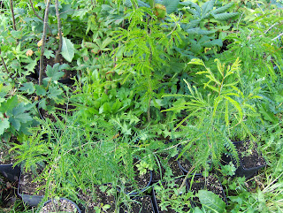
 Jumaltenpuu - Tree-of-heaven (Ailanthus altissima)Viime keskiviikkona kävin taimistollani tarkistamassa tilanteita. Yllä oleva kuvasarja on otettu silloin. Siinä on kuvattuna ne lajit, jotka ovat lehdiltään hallanarimpia. Niiden lehdet saattavat tällä viikolla tuhoutua jopa kokonaan, jos halla sattuu pahasti kohdalle. Tämä aamu oli tähän mennessä kylmin; tälläkin paíkalla lämpötila oli 2 metrin korkeudella n. +3 - +5 astetta alimmillaan, joten maan pinnassa on saattanut olla vähän hallaa. Nuo kasvit selvisivät ehkä vielä, mutta kaksi seuraavaa yötä ovat vielä melko heikkotuulisia ja vähäpilvisiä...Kylmä sääjakso ei ole vielä vaikuttanut ruskan alkamiseen poikkeuksellisesti. Puut ja pensaat ovat vielä normaaliin tapaan käytännössä kokonaan kesäasussa ja esim. metsävaahterassa (Acer platanoides) on tyypilliseen elokuun lopun tapaan vain vähän syysvärien haaleita alkuja siellä täällä. Viime aikaisista runsaísta sateista ja kosteasta helteestä on ollut se vaikutus, että monet kasvit ovat innostuneet vielä uuteenkin kasvuun. Taimistollani tämä oli selvästi havaittavissa melkein joka lajin kohdalla (kuten kuvistakin osaksi näkyy). Kevään typpipitoinen lannoitus vaikuttaa vielä äskettäistä syyslannoitusta enemmän, vaikka syyslannoiterakeet ovat liuenneet melko hyvin. Hallanvaaran takia yhä jatkuva voimakas kasvu on hyvin huolestuttava seikka...Last wednesday i went to my nursery to check out situations. The upper photo set is taken at that time. In there are photographed the species, which are the most sensitive to frost regarding their leaves. Their leaves may be damaged even completely during this week, if the ground frost hits the area in a bad way. This morning was the coldest so far; at this spot as well the temperature at the altitude of 2 metres was between about +3 C and +5 C at the lowest, so therefore there may have been a bit of ground frost on the surface of the land. Perhaps those plants got through yet from the situation, but the two following nights will be rather calm and clear yet...The cold weather period hasn't affected unusually to the start of the fall colours yet. Trees and shrubs are yet practically in full summer foliage in a normal way and for example on Norway Maple (Acer platanoides) there are in a typical way of the end of August only a bit of slight beginnings of fall colours here and there.From the recent heavy rains and the humid heatwave there have been that effect, that many plants have been urged to a new growth as well. In my nursery this was clearly noticed among allmost every species (as it is seen partly from the photos). The nitrogen flavoured fertilizing of the spring is affecting yet more than the recent autumn fertilizing, allthough the fertilize grains have been dissolved rather well. Due to the risk of ground frost a further continuing strong growth is a very worrying matter...
Viime aikoina olen ollut yhä saamaton arboretumprojektini suhteen, joten siitä ei ole uutta kerrottavaa vielä. Aikaa on mennyt (ja menee tällä viikolla yhä mm. kaksiin syntymäpäiväjuhliin) muihin puuhiin ja uuteen tietokoneeseeni tutustumiseen. Se on Hewlett Packardin Pavilion Dv6500 läppäri. Pienen harjoittelun jälkeen (käytän ensimmäistä kertaa Windows Vista -ohjelmistoa) olen ollut hyvin tyytyväinen sen toimintaan.Aikaisemmin en ole itse asiassa omistanut tietokonetta, vaan olen käyttänyt "milloin mitäkin konetta". Nyt bloggaamisprojektini helpottuu, mutta olen edelleen pohtinut blogitrilogiani mielekkyyttä; Flickr -sivuille on helppo ladata paljon kuvia, mutta tekstien luominen niihin kuviin blogiympäristössä tuntuu hyvin vaivalloiselta ja päivittäminen on hidasta. Päivityksen viive kasvaa kasvamistaan. Minulla olisi paljon mielenkiintoista asiaa annettavaksi niiden kuvien yhteydessä, mutta asioita täytyisi vähentää yhä lisää...Etelä-Suomen kasvienviljelysäästä lopuksi: Viime perjantai oli tällä erää viimeinen kunnolla kesäinen päivä (lämpötila yli +20 astetta) ja viime torstaina ukkosti ankarasti mm. Hämeenlinnan seudulla (tällä kertaa ei niinkään pääkaupunkiseudulla). Sen jälkeen matalapaineet ovat asettuneet Suomen ylle ja sen itäpuolelle; länsi - pohjoistuulten myötä sää on kylmentynyt päivittäin ja eilisestä lähtien päivälämpötiloissa on jääty alle +15 asteeseen. Sadetta on saatu kohtalaisesti - runsaasti esim. viime torstain ukkosiin liittyen. Tuulet ja runsas pilvisyys ovat pitäneet yölämpötilat vielä suhteellisen korkeina (vain vähän alle +10 astetta), mutta viikon loppupuolella yhä ajankohtaan nähden hyvin viileässä säässä on selvä hallanvaara sään seljetessä ja tuulten tyyntyessä.Hallan sattuminen näin varhaisessa vaiheessa on melko harvinaista. Kasvien kasvattamisen urallani muistan, että vuonna 1995 oli edellisen kerran tuhoja tehnyttä hallaa jo elokuun lopussa. Harmillista, jos niin käy tänä vuonna. Ainakin alaville ym. hallanaroille maille kannattaa nyt luoda hallantorjuntaa (mikäli mahdollista) tai viedä arat kasvit yöksi sisätiloihin, sillä tarpeellisia kasvu - kehitysvaiheita ennen talvea olisi näin varhaisessa vaiheessa vielä jäljellä. Pahimmillaan esim. mustaseljan (Sambucus nigra) ja viiniköynnösten (Vitis sp.) marjat eivät ehtisi kypsyä. Joka tapauksessa kasvukauden tilanteessa ollut kahden viikon etumatka taantuu normaaliin syyskuun alkuun mennessä pitkään jatkuvan viileän sään takia...Lately i have been further lazy regarding my arboretum, so there isn't new to tell about it yet. Time have been spend to other activities (and will further be so during this week like due to two birthday parties) and to get to know my new computer. It is a Hewlett Packard Pavilion Dv6500 notebook PC. After a little bit of practizing (i use Windows Vista software for the first time) i have been very satisfied towards its functioning.Actually i haven't been owned a computer before, but i have been using "whatever computer there was around". Now my blogging project will be easier, but i have been further considering about the sensibility regarding my blog trilogy; it is easy to upload plenty of photos into the Flickr pages, but creating texts to those photos in the blog environment feels very laboured and the updating is slow. The delay of the updating grows further more. I would have a lot of interesting matters to give with those photos, but one would have to decrease matters further more...To the end about the plant cultivating weather of southern Finland: Last friday was the last properly summery day (the temperature over +20 C) for now and there thundered severly last thursday for example around Hämeenlinna region (not so around Helsinki area). Since then low pressures have been settling over Finland and to the eastern side of it; due to westerly - northerly winds the weather have been turning cooler day by day and since yesterday afternoon temperatures have been remaining under +15 C. There have been rain moderately - a lot for example as associated with the thursday's thunder. Winds and a plentifull cloudyness have been keeping the night temperatures rather high yet (only little under +10 C), but during the latter part of the week in a further very unseasonably cool weather there will be a clear risk of ground frost as the weather will be clearing and the winds will be easing.The appearing of the ground frost is rather rare at so early phase. During my plant cultivation career i remember, that 1995 was the previous time there was a damaging ground frost allready at the end of August. It will be annoying, if that happens this year. At least on low and other frost sensitive grounds it is now worth to create frost prevention (if possible) or remove sensitive plants indoors for the night, because there would be necessary growing - developing phases left before winter at this early stage. At the worst for example berries of Black Elderberry (Sambucus nigra) and Grapes (Vitis sp.) wouldn't have time to become ripen. In any case the two week long advance that was in the growing season's phase will die down into normal until early September due to the cool weather continuing further for a long time...
Nyt Flickr -sivuilleni on päivitetty elokuun 2007 kuvia 11. päivästä 23. päivään asti. Tässä ovat linkit niihin; blogi 1, blogi 2 ja blogi 3. Ko. jakso sisältää mm. kesän voimakkaimmat ukkoset; katsokaapa, miten ne ilmenivät kaikissa kolmessa blogissa.Now there is updated photos of August 2007 into my Flickr pages from the 11th day up to the 23rd day. Here are the links to them; the blog 1, the blog 2 and the blog 3. The period in question includes for example the severest thunderstorms of the summer; do check it out, how they appeared in the all three blogs.
Tässä vaiheessa merkintä viime aikaisista tapahtumista. Ensinnäkin olen ostanut uuden tietokoneen (siitä myöhemmin lisää), jonka takia olen pitänyt taukoa bloggaamisessa.Sään suhteen parhaillaan on kehittymässä hieno ukkostilanne etelärannikolla. Tilanne muistuttaa viime toukokuun lopussa ollutta tilannetta; kaakosta pyrkii hyvin kosteaa ja helteistä ilmaa, mutta se etenee vain niukin naukin etelärannikolle. Seurauksena on kenties todella rajuja ukkosia ja hyvin runsasta sadetta. Parhaillaan jyrisee jo ja on hyvin pimeää...Muutoin sään ja kasvien kasvatuksen suhteen olosuhteet ovat jatkuneet hyvinä edellisen merkinnän jälkeen. Parin viime päivän vähän viileämmästä säästä huolimatta kasvukausi jatkuu äskettäisten helteiden ansiosta jopa n. kaksi viikkoa edellä tavanomaisesta aikataulusta. Se näkyy nyt mm. varisseina omenoina kotipuutarhoissa, kypsyvinä mustaseljan (Sambucus nigra) ja viiniköynnösten (Vitis sp.) hedelminä / marjoina ja punertuneina syyshortensioiden (Hydrangea paniculata "Grandiflora") kukintoina. Tässä vaiheessa tosin on huomattava, että lähes kaikki kotimaiset lajit ovat lopettaneet kasvunsa, jolloin lähinnä em. kaltaisista ulkomaisista lajeista on kasvukauden vaiheen indikaattoreiksi.Tällä viikolla en ole vielä tehnyt arboretumiini liittyviä töitä, mutta palaan ajallaan asiaan.Päivitys klo. 11.10.: Helsinkiin annettiin ukkosen takia yleinen hätämerkki klo. 10.50.!Päivitys klo. 11.20.: Hälytysmerkki oli ilmeisesti salaman aiheuttama. Täällä Helsingin keskustassa (jossa olen töissä) salamointi oli äsken todella rajua ja salamat iskivät useita kertoja n. 50 m päähän minusta (meistä)!Päivitys klo. 11.40.: Nyt ukkonen on hieman hiipunut... Tässä on muutama linkki ukkosmyrskyyn; 1, 2, 3 ja 4.Päivitys klo. 12.40.: Voimakkain ukkossolu on nyt ohi Helsingistä, mutta jyrinää kuuluu edelleen etäältä; sadetutkakuvat näyttävät nyt hyvin, missä ukkonen raivoaa parhaillaan ja miltä sadealueet näyttivät aamun aikana. Päivän aikana on ilmeisesti lisää ukkosta tiedossa, mutta jo nyt tämä päivä jää historialliseksi ja tämän kesän ylivoimaisesti parhaaksi ukkospäiväksi ympäri Etelä-Suomea. Yritin kuvata tätä ukkosta, mutta erään ikkunan läpi saadut otokset eivät ehkä läpäise seulaani Flickr -sivuilleni...Päivitys klo. 15.00.: Tässä on vielä kaksi linkkiä lisää ukkoseen liittyen: 1 ja 2. Tässä on lisäksi Iltasanomien lukijoiden kuvia ja videoita ukkosesta. Kaikista linkeistä voi nyt lukea ja katsoa kattavasti mm. ukkosen aiheuttamista tuhoista. Näin ukkosta ennustettiin (katso ennuste) A-J Punkan toimesta eilen. Parhaillaan Helsingissä on ollut muutaman tunnin poutaa, mutta Etelä-Suomessa on edelleen monin paikoin kovaa ukkosta...Päivitys klo. 19.50.: Nyt ukkoset näyttävät olevan tältä päivältä ohi. Hieno päivä tämä onneksi oli (heh, nyt tiedätte varmasti, että olen suuri ukkosfani)! Ukkosen rajuutta kuvasi se, että en muista edellistä niin hämärää hetkeä lähellä keskipäivää; oli jopa niin pimeää, että keinovalaistus näkyi kuin selvästi ennen auringon nousua ja rakennuksen sisällä oli kuin yö. Salamoiden valot näkyivät hyvin ja sisällä oli siksi disco- / clubitunnelma :) Olen tänään töiden jälkeen tarkastellut ja kuvannut ukkosen jälkiä täällä Espoon Tapiolassa. Kuvasatoa siitä tulee lähiaikoina Flickr -sivuilleni. Tässä on linkkejä Ilmatieteenlaitoksen sivuille, joissa on lisää tietoa ko. ukkosesta; 1 ja 2. Huomenna Etelä-Suomessa on viikon lämpimin päivä ja sää aurinkoinen. Lämpötila kohoaa +25 asteen ylikin, joten nihkeä kesäsää jatkuu. Sitten sää kuitenkin viilenee jo hieman syksyä enteillen, kun lännestä tulee aktiivista matalapainetoimintaa. Viileneminen ei vielä tarkoita syksyn alkamista, sillä vuorokauden keskilämpötilat pysyvät yli +10 asteessa. Kasvien kasvattajien ei tarvitse pelätä vielä hallaakaan. Sadetta on tiedossa runsaasti heti huomisen jälkeen ja nähtäväksi jää tuleeko viimeistään perjantaina taas rajua ukkosta. Merkkejä siihen on olemassa...Mainitsen vielä lopuksi tuohon edelliseen merkintään liittyen, että silloin ei ko. yönä tullut voimakasta ukkosta. Heräsin tosin eräässä vaiheessa unesta muutamaan ukkosen jyrinään.
At this phase a post concerning recent happenings. At first, I have bought a new computer (more about it later) and that is why i have been keeping a pause in blogging.Concerning the weather there is currently evolving a fine thunder situation by the southern coast. The situation is resembling the situation at the end of last May; there are pushing very humid and hot air from the southeast, but the air mass arrives barely to the southern coast. As a result there may be even very severe thunderstorms and very heavy rain. At the moment thunder rumbles allready and it is very dark...Otherwise concerning the weather and plant cultivation the circumstances have been continuing finely after the previous post. Despite a bit cooler weather of the last couple of days the growing season continues even about two weeks ahead of the average schedule thanks to the recent heatwave. That is seen now for example as shed apples in home gardens, ripening fruits / berries of Black Elderberry (Sambucus nigra) and Grapes (Vitis sp.) and reddish flowerheads of Panicle Hydrangea (Hydrangea paniculata "Grandiflora"). At this stage though, one must observe that most of the native species have been ended their growth, so mainly just the mentioned kinds of foreign species are suitable as indicators of the phase of the growing season.This week I haven't done any tasks yet concerning my arboretum, but I will return to the matter in time.Update at 11.10 AM: There was given emergency civil defence warning signals in Helsinki at 10.50. AM due to the thunderstorm!Update at 11.20 AM: Apparently the emergency civil defence warning signal was caused by the lightning. Here at the center of Helsinki (where i'm at work) lightning was just a moment ago very severe and lightning bolts hit several times within the distance about 50 metres from me (us)!Update at 11.40 AM: Now the thunderstorm is weakened a bit... Here are few links to the thunderstorm: 1, 2, 3 and 4 (unfortunately only in finnish).Update at 12.40 PM: Now the strongest thundercell is gone over Helsinki, but thunder rumbles further more in the distance; the precipitation radar pictures show now well, where the thunder rages at the current moment and what the precipitation areas looked like during the course of the morning. Apparently there is more thunder in the forecast during the day, but allready now this day remains in history and the best thunder day of the summer by far around southern Finland. I tried to photograph this thunder, but pictures photographed through a some window might not pass into my Flickr pages...Update at 3.00 PM: Here are two more links associating with the thunder; 1 and 2. These links are in english; 1 and 2. In addition here are photos and videos of Iltasanomat evening paper readers regarding the thunder. From all links one can now (read) and Watch extensively for example about the damages caused by the thunder. At this moment there have been rainless and fair weather for a few hours at Helsinki, but there are further severe thunderstorms in many places around southern Finland...Update at 7.50 PM: Now the thunderstorms are seeming to be over for today. A fine day it fortunately was (Hih, now you now for sure, that i am a big thunder fan)! The intensity of the thunder was described the fact, that i don't remember other such a dim moment near noon; it was so dark, that the artificial lights were seen like clearly before a sunrise and inside a building it looked like it was night. Light of the lightning bolts showed well and therefore it was a disco / club atmosphere indoors :) I have been observing and photographing marks of the thunderstorm here at Tapiola district in Espoo after work. A crop of photos of that will be on my Flickr pages in the near future. Tomorrow there will be the warmest day of the week and the weather will be sunny in southern Finland. The temperature will rise even over +25 C, so therefore a sultry summer weather continues. However, then the weather will cool down foreseeing autumn a bit allready, as there will be coming an active low pressure action from the west. The cooling doesn't mean yet a start of autumn, because the daily average temperatures will be over +10 C. People cultivating plants doesn't need to be worried about a ground frost either. There will be a lot of rain in the forecast immediately after tomorrow and it remains to be seen, if there will be severe thunder again during friday at the latest. There are signs indicating into that direction...I mention to the end regarding that previous post, that there wasn't heavy thunder during that night. I woke up at some point from my sleep due to few rumbles of thunder, though.
Eilen kävin arboretumalueellani tutustumassa paikan tilanteeseen kuukauden tauon jälkeen ja tein syyslannoitusta muutamille talvenaroille lajeille. Ne olivat; karvashikkori (Carya cordiformis), valeakaasia (Robinia pseudoacacia), pagodipuu (Sophora japonica) ja eteläntrumpettipuu (Catalpa bignonioides). Annoin lannoitetta myös melko kestävillekin lajeille; vuorivaahtera (Acer pseudoplatanus), rusokirsikka (Prunus sargentii) ja sirovaahtera (Acer sieboldianum). Ajanpuutteen vuoksi työ jäi kesken, joten jatkan lannoitusta vielä seuraavalla käyntikerralla ja istutustöiden aloitus siirtynee aiotusta aikataulusta. Havainnot paikalla kertoivat mm. sen, että kuivuus ei ollut ehtinyt vaivaamaan viime aikaisissa helteissä ja ukkoset olivat tuoneet mukavasti lisää kosteutta maahan. Hirvetkään (Alces alces) eivät olleet syöneet enää kasvejani. Pyrin tämän kuun aikana valokuvaamaan taas tunnelmia alueelta ja kerron sitten lisää alueen tilanteesta kuvien julkaisun yhteydessä.Tänään erittäin mielenkiintoinen asia sään suhteen on lännestä saapuvaan rintamasysteemiin mahdollisesti liittyvät rajut ukkoset ja vaaraa aiheuttavat tuulet. Näissä blogeissa / kotisivuilla tätä herkullista ukkosriskiä on jo pohdittu; 1, 2 (katso ennuste). Myös Estofex kertoo tästä säätilanteesta ennusteessaan. Näyttäisi siltä, että täksi illaksi ja ensi yöksi olisi tiedossa taas erinomaista ukkosnäytelmää, jopa huippuluokan meininki voi olla mahdollista. Se tietäisi vähäisiä yöunia jälleen kerran... Tämä säätilanne on tuon Paulin blogin mukaan erikoinen, joten epävarmuutta tapahtuvan suhteen on; ukkonen voi jäädä pettymykseksi. Joka tapauksessa kasveille voi paikoin olla tiedossa jopa liikaa sadetta...Yesterday i visited my arboretum area to observe the situation over there after a month's break and i made autumn fertilizing to some not so hardy species. They were Bitternut Hickory (Carya cordiformis), Black Locust (Robinia pseudoacacia), Japanese Pagoda tree (Sophora japonica) and Indian Beantree / Southern Catalpa (Catalpa bignonioides). I gave fertilizer to rather hardy species as well; Sycamore Maple (Acer pseudoplatanus), Sargent Cherry (Prunus sargentii) and Siebold's Maple (Acer sieboldianum). Due to a lack of time the work remained unfinished, so i will continue fertilizing during the next visit and the start of the planting tasks will propably happen later than scheduled. Observations made in the area told for example as follows; a drought didn't had time to appear during the recent heatwave and the thunderstorms had been given finely more moisture to the ground. Even mooses (Alces alces) hadn't been eaten my plants anymore. I will aim to photograph more atmospheres again at the area during this month and i will tell then more about the situations at the area at the time of the photo publish.Today a very interesting matter concerning the weather are possible severe thunderstorms and dangerous wind conditions associating with a frontal system approaching from the west. In couple of blogs / pages this delicious risk of thunder have been considered allready (found only in finnish). Also Estofex tells about this weather situation in its forecast. I would seem, that during this evening and the following night there would be appearing again an excellent thunder show, even a first class action may be possible. That would mean too little sleep once again... This weather situation is said to be peculiar (according to the first link's blogger Pauli), so there is uncertainty associating with the things to happen; thunder may become as a disappointment. In any case there might be locally even too much rain for the plants...
Viime yönä ukkosti vihdoin kovaa pääkaupunkiseudulla ja monessa muussakin paikassa Etelä- ja Keski-Suomessa. Iltasanomien sääkuvapalstallakin se näkyy nyt hienoina ukkoskuvina. Päivän aikana ukkoskuvia tulee palstalle todennäköisesti lisää liittyen muihinkin ukkosiin eilisen ja yön aikana... Itsekin olin viime yönä kameran ja jalustan kanssa kuvaamassa ja ukkoskuvia (myös päiväajalta) julkistan lähiaikoina Flickr -päivityksen yhteydessä; Taivaankansi - Firmament ja Maan Povi - The Bosom Of The Earth blogit. Eilinen oli muutenkin hyvä ukkospäivä, kun ukkossoluja liikkui vähän ennen puolesta päivästä lähtien useita etelästä pohjoiseen ja ainakin kolme (mukaan lukien viime öinen) meni ylitse siellä missä satuin olemaan; Helsinki - Espoon Tapiola. Sadetutkakuvien perusteella arvioin, että sekä taimistoni että arboretumini Sipoossa saivat näistä ukkosista paljon vettä. Nyt ilmamassa on kuivempi kuin aikaisempina päivinä, mutta viilenemistä tapahtuu vain vähän ja asteittain...Last night there was finally severe thunderstorm around capital city area (Helsinki) and around many other places as well in southern and central Finland. On the weather photo page of Iltasanomat as well that is now showing as fine thunder pictures; photos mostly from different parts of Helsinki, but also for example from Jyväskylä as well. During the day there will propably be more thunder photos added to the page associating with other thunderstorms as well during yesterday and the last night... I was also photographing at last night with my camera and tripod and i will publish some thunder photos (from the daytime as well) along with the Flickr update in the near future; Taivaankansi - Firmament and Maan Povi - The Bosom Of The Earth blogs.Yesterday was a good thunder day in other means as well, because from a bit before noon onwards there moved several thunder cells from the south to the north and at least three (including the one last night) crossed the scene where i happened to be; Helsinki - the district of Tapiola in Espoo. According to the precipitaiton radar pictures i estimated, that both my nursery and the arboretum area in Sipoo received a lot of rain from these thunderstorms. Now the air mass is drier than during previous days, but a cooling will happen only a little and cradually...
Eliset ukkoskuurot toivat vettä tyypilliseen kesäiseen tapaansa niin, että paikalliset erot sademäärissä olivat suuria. Esim. Espoon Tapiola sai jonkin verran sadetta, mutta heti Helsingin itäpuolella kuulemma ei juuri ollenkaan. Sen sijaan Porissa vettä satoi parissa tunnissa n. 50 mm. Tässä on linkki Iltasanomien lukijoiden sääkuvapalstalle, jossa on nyt "tulvimalla" kuvia ko. sateen aiheuttamista tulvista.Tänään menen vielä taimistolleni tarkistamaan siellä tulleen sademäärän ja kastelen kasveja joka tapauksessa varmistaakseni niiden kosteuden saannin; tänään ja huomenna ukkoskuuroja voi tulla, mutta sitten olisi pari poutaisempaa päivää... Sää jatkuu hyvin lämpimänä viikon loppupuolelle asti, joten astiataimien kastelulla on tarvetta. Alle 20 millimetrin suuruinen sade on melko riittämätön voimakaskasvuisille astiataimille näin kuumalla; tänäänkin lähes +30 astetta. Kuivumista ehkäisee onneksi sama seikka, joka estää purkkitaimiani kaatumasta kovalla tuulella; olen antanut niiden juurtua tarkoituksella maahan purkkien pohjien rei'istä. Viimeistään tällä tai ensi viikolla on vuorossa myös syyslannoitteen antaminen; lannoiterakeiden on liuettava ja vaikutettava ennen ruskaa.Päivitys 14.8.2007: Ilmatieteenlaitos on antanut lisätietoa Porin sademääristä; sadetutkahavaintoihin perustuvan arvion mukaan Porin seudulla satoi viime sunnuntaina jopa lähes 100 mm!Eilen kävin taimistollani ja sademittarin mukaan paikalla ei satanut yhtään; ehkä muutama pisara korkeintaan. Niin epätasaisesti sade voi kastella kesällä Etelä-Suomea. Kasvien kastelulle oli siten selvä tarve. Päätin antaa samalla syyslannoitteen (ei sisällä typpeä tai sisältää hyvin vähän). Levitin ensin lannoiterakeet ruukkujen pinnalle ja sitten kastelin.Yesterday's thundershowers brought rain in a typically summery way so, that local differences were large concerning amounts of rain. For example the district of Tapiola in Espoo got some rain, but the areas immediately eastwards of Helsinki didn't got allmost nothing according to what i heard. In opposed to that Pori (a town by the western coast of Finland) got rain even about 50 millimetres in couple of hours. Here is a link to the weather photo page of the Iltasanomat evening paper readers, where the page is now "flooded" of photos relating to the floods caused by the rain in question.Today i will go the my nursery to check out the amount of rain that fell over there and i will water the plants in any case in order to make sure of their moisture supply. Today and tomorrow there may come thundershowers, but then there would be couple of rainless days. The weather will continue very warm up to the latter part of the week, so there is a need for watering container plants. A rain amount under 20 millimetres is rather insufficient for stronlgy growing container plants in such a hot weather; today as well allmost +30 C. Drying up is prevented fortunately by the same fact, that prevents the container plants from falling down during hard winds; i have intentionally let them root into the ground from the holes on the bottoms of the containers. During this or the next week at the latest it will be time for autumn fertilizing as well; the fertilizer grains must be dissolved and affected before autumn / fall colours.Update the 14th of August 2007: The Finnish Meteorological Institute has given new information concerning the amounts of rain in Pori (unfortunately only in finnish); according to an estimation based on the precipitation radar observations there rained even allmost 100 mm around Pori region last sunday!Yesterday i visited my nursery and according to the hydrometer there rained nothing on the spot; perhaps few drops at the most. So unevenly the rain can fall in southern Finland during summer. Therefore watering of the plants was clearly needed. I decided to give autumn fertilize (doesn't include nitrogen or includes very little) at the same time. I placed the fertilize grains on the surfaces of the containers at first and then i watered.
Tänään on ollut jo runsaita sadekuuroja liikkeellä mm. täällä Hämeenlinnan seudulla, mutta ukkosta ei vielä ole kuulunut... Sadetutka näyttää nämä voimakkaat kuurot hyvin ja lähipäivinäkin tällainen ukkosherkkä säätyyppi jatkuu. Näitä sateita voi seurata hyvin myös Tiehallinnon kelikameroista. Niistä voi seurata myös muun teiden ja katujen varsilla olevan luonnon kehittymistä erinomaisesti; esim. kevään (lehtien puhkeaminen) ja syksyn (ruskan eteneminen) kehittymistä ja niiden eroja Suomen eri osissa. Tietenkin myös talven lumitilanteet näkyvät hyvin.Today there have allready been profuse showers on the move for example here around Hämeenlinna area, but thunder hasn't been heard yet... The precipitation radar shows these showers well and also during following days this kind of thundery weather type continues. These rains can be observed well also from the weather cameras of Tiehallinto (A finnish road administrator). From them one can observe also progression of other nature beside roads and streets in an excellent way; for example proceeding of spring (unfolding leaves) and autumn (proceeding of fall colours) and differences of them between different parts of Finland. Ofcourse snow conditions of winter are showing finely as well.
On aika aloittaa elokuun 2007 Flickr kuvasarjojen kokoaminen liittyen blogitrilogiaan. Tässä on ensimmäinen päivitys tähän päivään asti (ei sisällä illan kuvia) kuun alusta; blogi 1, blogi 2 ja blogi 3.It is time to start compiling the Flickr photo sets of August 2007 associating with the blog trilogy. Here is the first update up to this day (doesn't include the photos of the evening) from the start of the month; the blog 1, the blog 2 and the blog 3.
 Saksanpihlaja - Whitebeam (Sorbus aria)
 Amurinorapihlaja - A Hawthorn species (Crataegus maximowiczii)
 Ptelea - Hoptree / Stinking Ash (Ptelea trifoliata)Maanantaina 6.8. ja eilen 9.8. tein taimistollani tämän kauden viimeiset purkkien vaihdot toistaiseksi. Ensimmäisenä uudet isommat purkit saivat alimman kuvan pteleat ja eilen löytyi muutamia yksittäisiä "jämiä", jotka otan vielä jatkokasvatukseen (ylemmät kuvat). Nyt sain taimiston loppukesäksi siihen kuntoon, että voin keskittyä itse arboretumalueeseen Sipoossa. Edelleen jatkuvat helteet tosin tietävät sitä, että ilman kunnon sateita ohjelmassa on taimiston kastelua. Eilen vietin paikalla yli tunnin vesiletkun päässä. Kaksi kastelukertaa viikossa on ollut näissä olosuhteissa riittävä. Kuvat on otettu eilen.Etelä-Suomessa on ollut koko viikon päivisin +25 asteesta lähes +30 asteeseen ja yötkin ovat olleet lämpimiä selkeästä säästä huolimatta; n. +15 astetta ja etelärannikolla useana yönä jopa lähes +20 astetta (merivesi on lämmennyt paikoin +20 asteiseksi). Ilma on ollut kosteahkoa, mutta sadetta ei ole tullut ollenkaan. Viikonloppu ja ensi viikon alku näyttävät edelleen hyvin lämpimiltä; päivisin on yleisesti hellettä sunnuntaihin asti ja sen jälkeen ainakin osassa Etelä-Suomea. Epävakaisuus lisääntyy, mikä tietää kosteuden ja pilvisyyden lisääntymistä; yölämpötilat saattavat jäädä sen takia paikoin jopa +20 asteen tienoille, mikäli ilmamassa säilyy hyvin lämpimänä. Ukkosriski kasvaa samalla ja toivottavasti saamme kesän parhaat ukkoset. Kasvillisuus kaipaa jo lisää vettä. Sateeton ja enimmäkseen täysin selkeä sää on jo saanut paahteisimpia paikkoja kuivumaan (kellastuva nurmikko), mutta muutoin kasvukausi on edennyt erittäin hienosti. Kasvu ja kehitys on nopeutunut lämmön myötä niin, että tämän viikon loppuun mennessä kasvukausi on taas yli viikon edellä tavanomaisesta aikataulusta. Käytännössä tämä näkyy nyt mm. maitohorsman (Epilobium angustifolium) siementen runsaana leviämisenä, pietaryrtin (Tanacetum vulgare) kukinnan loppumisena, kotipihlajan (Sorbus aucuparia) kypsinä marjoina, terttuseljan (Sambucus racemosa) varisseina marjoina, tammen (Quercus robur) lähes täysikasvuisina terhoina ja syyshortensian (Hydrangea paniculata "Grandiflora") täytenä kukintana; osa sen lämpimien kasvupaikkojen kukinnoista on alkanut jo punertumaan. Maanviljelyssä tämän viikon kuuma ja aurinkoinen sää on saanut puintityöt täyteen vauhtiin, mutta metsäsienten hyvin alkanut satokausi on alkanut hidastumaan ilman sateita.Jos lähipäivinä tulee riittävästi ukkossateita, niin kasvien kasvatus jatkuu erinomaisissa merkeissä; ainoa vaiva lienee home- ym. lämpimän kosteasta pitävien tautien riski ja se, että jäljellä oleva hyötykasvien sato valmistuu ehkä liian nopeasti; kuten varhaiset omenalajikkeet. Talvenarkojen ulkomaisten lajien osalta tämä säätyyppi on mieleeni; monella kasvattamallani lajilla uusien oksien kasvua on vielä jäljellä ja kasvun puutuminen on melko paljon kesken, joten kaikki lämpö on tervetullutta. Kotimaisista puista ja pensaista suurin osa on jo päättänyt / päättämässä kasvunsa.On monday the 6th of August and yesterday the 9th of August i did the last container changes of the season at my nursery for now. At first new bigger containers were changed to the Hoptrees in the lowest photo and yesterday there were found single "left overs", which i will keep yet in the cultivation (the upper photos). Now i got the nursery in such a condition for the late summer, that i can now consentrate for the actual arboretum area in Sipoo. However, the further continuing heatwave means, that without proper rains there will be scheduled watering of the nursery. Yesterday i spend more than an hour at the tip of the water hose. Two watering times per week has been enough in these circumstances. The photos are taken yesterday.During afternoons of all week the temperatures have been from +25 C to allmost +30 C in southern Finland and nights have been warm as well despite clear skies; about +15 C and by the southern coast even allmost +20 C during several nights (the sea water has been warmed up locally to +20 C). The air has been rather humid, but there hasn't been rain at all. The weekend and the early part of next week will seem to be further very warm; during afternoons there will be commonly hot (more than +25 C in the finnish terms) up to sunday and from there onwards at least in some parts of southern Finland. Unstableness of the weather will increase, which means increasing of humidity and cloudyness; due to that night temperatures will remain even at about +20 C, if the air mass will remain very warm. The risk of thunder will got higher at the same time and hopefully we will get the best thunderstorms of the summer. Vegetation is longing for more water allready.The rainless and mostly completely sunny weather has allready caused the most scorching localitys to dry up (lawns turning yellow), but otherwise the growing season has been continuing excellently. The growth and the progress has been fastened in such a way, that until the end of this week the growing season will be again more than a week ahead of the normal schedule. In practise this shows now for example as a profuse spreading of the Fireweed (Epilobium angustifolium) seeds, ending blooming of Common Tansy (Tanacetum vulgare), ripe berries of European Mountain Ash / Rowan (Sorbus aucuparia), shed berries of Red Elderberry (Sambucus racemosa), allmost full grown acorns of English Oak (Quercus robur) and full blooming of Panicle Hydrangea (Hydrangea paniculata "Grandiflora"); a part of its flower heads at warm localitys have been started to turn reddish allready. In agriculture this week's hot and sunny weather has got the thresing works ongoing in full speed, but the well started crop season of forest mushrooms has been started to slow down without precipitation.If there will be enough thunder related rains during following days, so the cultivation of plants will continue in excellent circumstances; the only harm may be a risk for mould and other humid and warm liking diseases and the fact, that the remaining crop of useful plants will be ripened perhaps too fast; like early apple cultivars. Concerning unhardy foreign plant species i like this weather type; with many species grown by me there is growth of new shoots left and the growth's forming into woody stage is rather much unfinished, so therefore all warmth is wellcomed. A most part of the native trees and shrubs have allready been ended / ending their growth.
Blogitrilogian blogia Maisema - Landscape on päivitetty syyskuun 2006 lopun osalta. Silloin oli erikoista poikkeuksellisen lämpimät säät; tässä on linkki blogiin.The blog trilogy blog Maisema - Landscape is updated for the end of September 2006. Then an exceptional feature were unusually warm weather conditions; here is the link to the blog.
Nyt heinäkuun 2007 Flickr kuvasarjat ovat valmistuneet kokonaan blogitrilogiaan liittyen. Tässä ovat linkit viimeisen kerran ko. sivuille; blogi 1, blogi 2 ja blogi 3. Tässä on samalla juuri valmistunut Helsingin Puistolan säätilasto ko. kuukaudelta, josta näette vallinneet sääolosuhteet hienosti myös siinä muodossa.Now the Flickr photo sets of July 2007 are finished completely associating with the blog trilogy. Here are the links for the last time to the pages in question; the blog 1, the blog 2 and the blog 3. In here is at the same time the link to the just completed weather chart of the Puistola district in Helsinki from the month in question, from where you can see finely the prevailed weather conditions in that form as well.
 Sirovaahtera - Siebold's Maple (Acer sieboldianum)
 Viiniköynnöksiä - Grapes (Vitis sp.)
 Vasemmassa alakulmassa huntuvaahtera (Acer triflorum) ja muut peruukkipensasta (Cotinus coggygria) - On the left lower corner Three-flowered Maple (Acer triflorum) and the others European Smoketree (Cotinus coggygria).
 Vasemmalla oratuomi (Prunus spinosa) ja oikealla kirsikkasorvarinpensas (Euonymus planipes) - On the left Sloe / Blackthorn (Prunus spinosa) and on the left Flat-stalked Euonymus (Euonymus planipes).
 Lehmuksia - Lindens / Limes (Tilia sp.)
 Keltakoivu - Yellow Birch (Betula alleghaniensis)Taas on aika kertoa viikon aikana tapahtuneista arboretumtöistä. Viime maanantain ja tiistain aikana oli tulossa se kesämyrsky ja ajattelin alunperin tehdä taimistotöitä vasta sen jälkeen. Maanantaina heti varsinaisen työni jälkeen menin kuitenkin taimistolle mm. tyhjentämään sademittarin myrskyä varten (silloin edellisen käynnin jälkeen oli satanut 5 mm) ja koska sade alkoi hitaasti tihkuna, niin ehdin tekemään purkinvaihtohommia jo maanantaina. Eilen torstaina viimeistelin sen osan töistä ja yllä on kuvia lajeista, joille vaihdoin isommat purkit. Kuvat on otettu eilen. Lehmusten ja viiniköynnösten osalta tarkka lajinmääritys on epäselvää, koska taimissa ei enää ollut nimilappuja ja molempia on ainakin kahta lajia; (Tilia tomentosa), (Tilia amurensis) sekä (Vitis riparia), (Vitis "Fredonia")...? Kaikki kuvien taimet olivat kaksi edellistä kesää melko hylättynä ja olin yllättynyt mm. noista vaahteralöydöistä, joita on tosin vain yhdet kutakin lajia. Muita kuvien lajeja on n. 5 - 10 kpl. Kirsikkasorvarinpensaat saavat olla vielä toistaiseksi vanhoissa purkeissa.Sitten vähän viikon säästä ja siitä myrskystä. Torstaina taimistolla paljastui myrskyn tuoma sademäärä ko. paikalla; mittariin oli tullut 30 mm sadetta. Myrsky ei onneksi kaatanut purkkeja isojen taimienkaan osalta. Siinä on auttanut se, että olen juuri tuulen takia antanut purkkien juurtua maahan. Se hankaloittaa hieman niiden siirtoa, mutta se kannattaa; muutoin purkit olisivat lähes joka päivä kumossa niin aukealla paikalla. Myrsky ei aiheuttanut eteläisessa Suomessa kovin paljoa tuhoa, mutta mm. sähkökatkoja oli jopa tuhansilla talouksilla kaatuneitten puiden takia.Alkuviikon aikana Etelä-Suomessa oli melko viileää päivisin (tiistaina vain n. +15 astetta ylimmillään), mutta öisin melko lämmintä (yli +10 astetta) tuulten ja pilvien takia. Nyt viikon loppupuolella sää on lämmennyt hitaasti pilvisyyden pysyttyä melko runsaana. Sadetta on kuitenkin tullut hyvin vähän tiistain jälkeen, mutta maaperä on nyt kasvien kasvua ajatellen ihanteellisen kostea. Viikonlopun aikana sää lämpenee helteeksi (+25 astetta ylittyy), kuten arvioin jo monta päivää sitten. Ensi viikon alussa helle näyttäisi yhä voimistuvan korkeapaineen ollessa päällä (jopa +30 astetta ylittyisi), joten kesän kuumin jakso tulee nyt. Yölämpötilatkin pysyvät silloin selvästi +15 asteen yläpuolella. Toivottavasti helle tietäisi myös ukkosherkkää säätä jossain vaiheessa, koska muutoin helle alkaa kuivattamaan kasvien olosuhteita huonoiksi jo ensi viikon lopulla ilman kunnon sateita... Purkkitaimet vaativat kastelua paljon aikaisemmin. Kasvukausi ei ole enää mainittavasti edellä tavanomaista aikataulua alkuviikon koleiden ja pilvisten iltapäivien takia. Lisäksi näin kasvukauden loppupuolella kasvien varsinainen kasvu alkaa olla lopuillaan ja kasvu on siten lähinnä valmistautumista talveen (silmujen kehitystä ja uuden kasvun puutumista puilla, pensailla ja köynnöksillä); kasvukauden tilanteen arvioiminen alkaa siis muodostua visuaalisesti epämääräiseksi ja lajikohtaisesti vaihtelevaksi. Tällä hetkellä mm. pietaryrtti (Tanacetum vulgare) ja pujo (Artemisia vulgaris) ovat täydessä kukassa. Puutarhoissa ja puistoissa syyshortensia (Hydrangea paniculata "Grandiflora") on vähintään puolikukassa ja musta-aronian (Aronia melanocarpa) marjat ovat puolikypsiä - kypsiä. Peltoviljelyssä puintityöt ovat jo paikoin alkaneet. Tuleva hellejakso kiihdyttää kasvien kasvua ja kehitystä hurjasti, koska kosteusolot ovat vielä sen verran optimaaliset.It is time again to tell about the happened arboretum works of the week. During last monday and tuesday there was coming that summer storm and i was originally thinking to work at the nursery after that. However, at monday immediately after my actual work i went to the nursery to empty the rain gauge for the coming storm (Then there was 5 millimetres of rain in the hydrometer after the previous visit) and because the rain started slowly as drizzle i had time to make container change tasks allready at monday. Yesterday in thursday i finished that part of the task and above there are photos of the species, which were changed into bigger containers by me. The photos are taken yesterday.The accurate determination of the Lime and Grape species is unclear, because there weren't namelabels anymore with the plants and there are at least two species of the both; (Tilia tomentosa), (Tilia amurensis) and (Vitis riparia), (Vitis "Fredonia")...? All species in the photos were rather abandoned during last two summers and i was surprised about the finding of those Maples, from which there are only one pieces of both, though. There are about 5 to 10 pieces of the other species in the photos. Flat-stalked Euonymus plants may be yet on their old containers for the time being.Then about the weather of the week and that storm. In thursday at the nursery there was revealed the amount of rain the storm brought to the region in question; there was 30 millimetres of rain in the hydrometer. Fortunately the storm didn't fall down the containers even regarding the big plants. There have been helping in this the fact, that i have been letting the containers to root onto the ground just due to the winds. It will make the removing of the containers uneasy, but that is worthwhile; otherwise the plants would be down allmost every day on such an open space. The storm didn't cause much damage in southern Finland, but amongst others there were power cuts in even thousands of households due to the fallen trees.During the early part of the week it was rather cool in afternoons in southern Finland (only even +15 C in tuesday at the highest), but at nights rather warm (over +10 C) due to the winds and the clouds. Now at the latter part of the week the weather has been warming up slowly as the skies have been remaining rather cloudy. However there have been rain very little since tuesday, but the soil of the ground is now essentially moist considering the growth of the plants. During the weekend the weather will warm up into a heatwave (+25 C will be topped), as i estimated allready several days ago. During the early part of the next week the heatwave would seem to strengthen further as a high pressure will be on (even +30 C would be topped), so therefore the hottest weather period of the summer will be coming now. Even night temperatures will remain clearly over +15 C then. Hopefully the heatwave would mean also thundery weather at some point, because otherwise the hot weather will start to dry up conditions of the plants for the worse allready at the end of the coming week without proper rains... Container plants will need watering much sooner.The growing season isn't notably ahead of the average schedule anymore due to the cool and cloudy afternoons of the early week. In addition here at the latter part of the growing season the actual growth of the plants is beginning to be at the end and the growth is therefore mainly prepairing for the winter (forming buds and making new growth woody on trees, shrubs and climbers); so the estimating of the growing season's phase will be forming visually unclear and variable regarding the species in question. At this moment for example Common Tansy (Tanacetum vulgare) and Mugwort / Common Wormwood (Artemisia vulgaris) are in full bloom. In gardens and parks Panicle Hydrangea (Hydrangea paniculata "Grandiflora") is at least in half bloom and Black Chokeberry's (Aronia melanocarpa) berries are half - full ripen. In the case of agriculture threshing works have allready been started locally. The coming heatwave will be increasing furiously the speed of growing and progress of the plants, because the humidity circumstances are yet so optimal.


